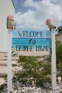
This week in Georgetown has been busy!
We’ve been doing the usual re-provisioning: fuel, water, food, laundry.
And, most importantly, we’ve been studying up for our big next legs south to Panama. After tons of consideration and over a year’s worth of hemming and hawing, here’s what we have decided (and are open to feedback on):
How’d we get here? In short, we wanted to take the 1) safest, and then, 2) most comfortable route. Without going into too much detail (we’re happy to, just email us) it’s a big combination of studying the weather, charts, pet-entry req’s, clearing in fees and then, prioritizing what we want to see along the way. Being willing to go “north to get south” (go out of your way to get a better sail) and waiting on the weather will serve you well on making big passages like this, or so we’ve been told. And, that’s what we intend to do.
First thing’s first, as you can see we’re headed West, with the Trade Winds instead of beating East across the north coast of the Dominican Republic and then beating again across the north coast of Puerto Rico. If we were to go that way, once we got to the USVI, we’d be set to follow little coastal jumps all the way down the chain. But, each of the 20-odd countries “down the chain” between “here” (The Bahamas) and “there” (Panama) has different pet entry regulations and entry fees for the boat. Turks and Caicos alone is $200 to enter (for a couple of days, no thanks) and some of the islands I really wanted to see (Dominica) don’t allow pets on shore. So, we’d skip these anyway therefore the advantage of short day sails between islands was kind of muted. Of all the things I’ll miss out on (this time) by not taking the Eastern route, I think I’ll miss the opportunity to see Saba the most: when told roads and an airport couldn’t be built, they did it themselves – my kind of folks!
Also, yes, Cuba (the forbidden zone) is on the way and the anchorage to check in at is just past Guantanamo Bay. If we stop we’ll likely just anchor off the coast to rest but the coast is so steep that we’ll be really close to land. So . . . we’ll keep you posted.
And, finally, yes, it’s a lot of open water after Jamaica, but we prefer the open water with the Trades over beating against the wind. And, we discovered there are a ton of little atolls along the way, which could break up the 3-day trip to San Andres (off the coast of Nicaragua), which is supposed to be great!
From there, it’s a “short” jump from San Andres to Bocas – from 36 hours to 72 depending on the weather.
We estimate the total sailing time on these legs to be about 1.5 weeks, which will be broken up with time ashore and time patiently waiting on the weather. So, just like that, we’re well on track to be in Panama by June, just as planned. Famous.last.words. 😉
I’m not sure what internet options will be available between here and Jamaica so stayed tuned on Spot and we’ll catch up on the flip side.
xoxox,
Laurie


